float/
deployment |
latest
profile |
time of GPS fix |
latest position |
max
depth(m)
| buoyancy
pump voltage |
| 8493.005 |
001 |
21-Mar-2013 00:00:00 |
0.00000° N |
0.00000° E |
400 |
14.20 |
|
DURIP Float 8493 was deployed 22 Mar, 2013 near the BOUSSOLE site, .
|
|
| 7729.001 |
299 |
29-Sep-2013 18:13:00 |
34.39759° N |
-67.36752° E |
973 |
10.00 |
| 7740.001 |
132 |
14-Nov-2012 18:29:00 |
32.71559° N |
-74.07295° E |
1131 |
13.90 |
|
Floats 7729 and 7740 were deployed May 2012 NW of Bermuda, courtesy of the R/V Knorr.
|
|
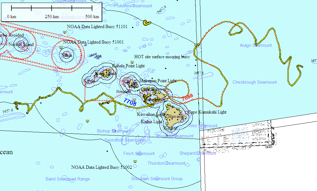
| 7688.001 |
335 |
28-Aug-2013 23:02:10 |
22.04786° N |
-147.79340° E |
997 |
8.50 |
| 7708.001 |
361 |
10-Nov-2013 00:31:40 |
20.17844° N |
-164.79910° E |
983 |
8.30 |
|
Floats 7688 and 7708 were deployed Dec 2011 at the MOBY site ESE of Lanai, Hawaii, courtesy of the MOBY Team from Moss Landing Marine Labs.
|
|
| 8478.001 |
024 |
07-Nov-2012 16:26:20 |
36.20675° N |
-63.47205° E |
413 |
14.00 |
|
DURIP Float 8478 was deployed Sep 27 in the North Atlantic, .
|
|
| 8377.001 |
027 |
11-Aug-2012 13:36:00 |
31.18770° N |
-64.30138° E |
1033 |
14.30 |
|
DURIP Float 8377 was deployed July 12 in the North Atlantic, .
|
|
| 8502.003 |
032 |
12-Jul-2012 02:59:00 |
63.23064° N |
-32.91652° E |
274 |
14.50 |
|
DURIP Float 8502 was deployed July 6 in the North Atlantic, .
|
|
| 8493.004 |
025 |
11-Jul-2012 07:56:10 |
61.76948° N |
-33.92081° E |
199 |
14.30 |
|
DURIP Float 8493 was deployed July 6 in the North Atlantic, .
|
|
| 8502.002 |
026 |
05-Jul-2012 17:07:40 |
61.89254° N |
-33.50984° E |
262 |
14.30 |
|
DURIP Float 8502 was deployed July 1 in the North Atlantic, .
|
|
| 8493.003 |
025 |
05-Jul-2012 06:57:10 |
61.58451° N |
-34.19435° E |
239 |
14.30 |
|
DURIP Float 8493 was deployed July 1 in the North Atlantic, .
|
|
| 8502.001 |
017 |
26-Jun-2012 11:43:00 |
53.09443° N |
-30.89925° E |
210 |
14.30 |
|
DURIP Float 8502 was deployed June 23 in the North Atlantic, .
|
|
|
| 8493.002 |
025 |
27-Jun-2012 12:38:40 |
53.35238° N |
-30.73470° E |
262 |
14.40 |
|
DURIP Float 8493 was deployed again June 23 in the North Atlantic>.
|
|
|
| 8493.001 |
009 |
19-Jun-2012 09:56:00 |
42.94368° N |
-27.21173° E |
285 |
14.70 |
|
DURIP Float 8493 was deployed June 17 in the North Atlantic, near 47 deg N, 24 deg W.
|
|
|
| 8386.001 |
009 |
22-May-2012 18:36:40 |
31.80896° N |
-65.00049° E |
701 |
14.40 |
|
Float 8386 was deployed May 18 near the BATS site SE of Bermuda by the R/V Atlantic Explorer. The float was apparently lost on 22 May during a recovery attempt.
|
|
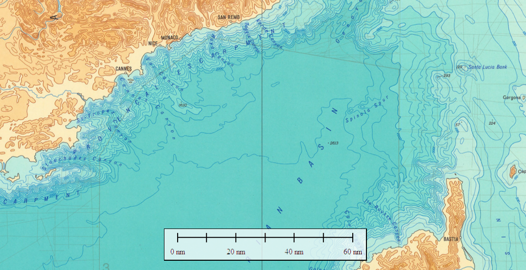
| 5293.001 |
029 |
16-Sep-2011 12:58:15 |
43.66348° N |
7.91774° E |
753 |
13.30 |
| 7054.001 |
029 |
16-Sep-2011 13:32:45 |
43.25526° N |
7.91307° E |
1049 |
13.20 |
|
Floats 5293 and 7054 were deployed Jul 2011 at BOUSSOLE site ESE of Nice with the help of Le Laboratoire d'Océanographie de Villefranche LOV. They were recoverd 17 Sep 2011 by LOV personnel during a BOUSSOLE cruise.
|
